Key features
Neighbourhood Allocation for 48 Units
Residential Development Land
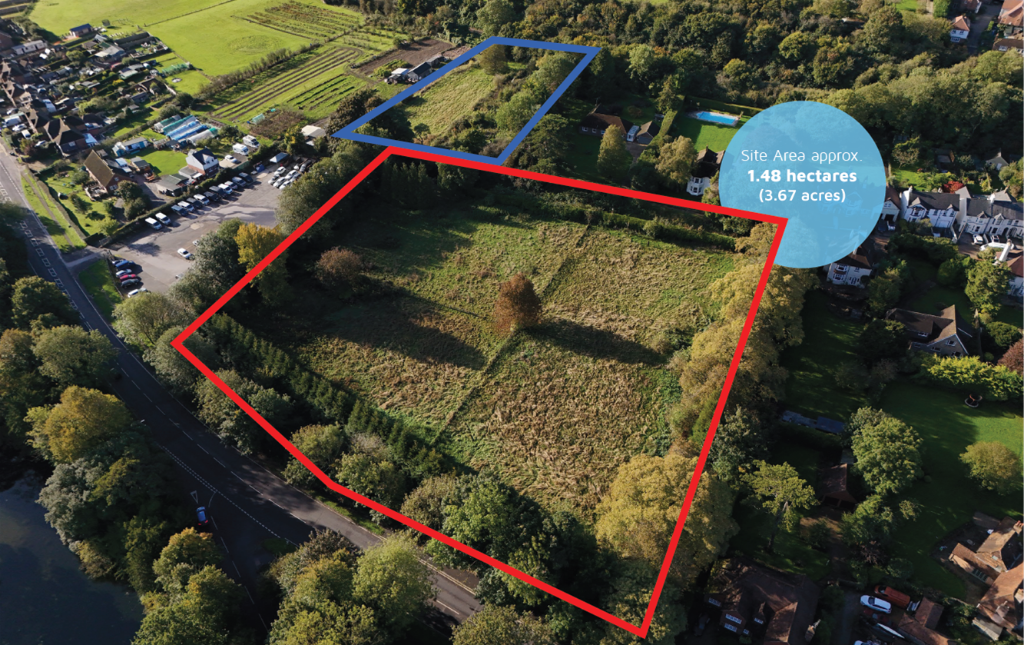
1.48 Hectares
Development Opportunity
Description
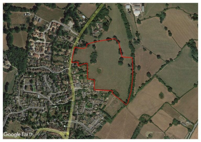
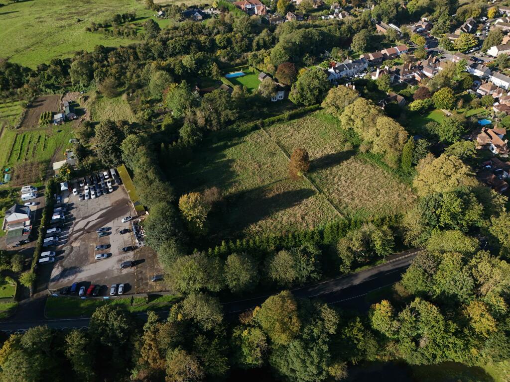
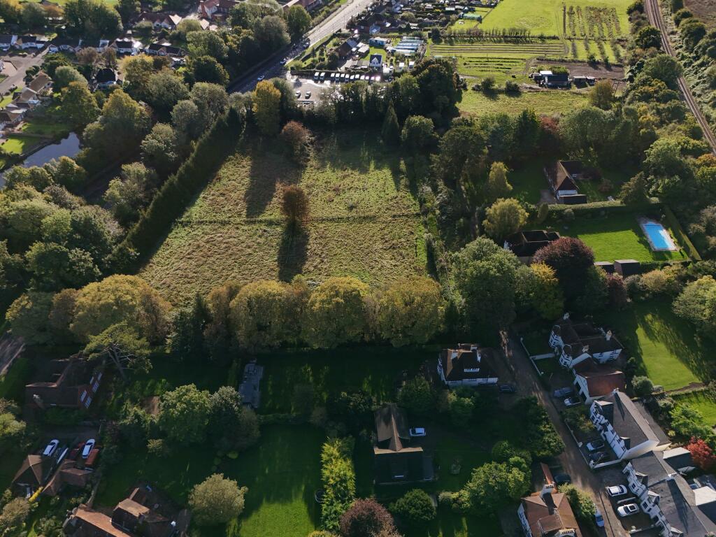
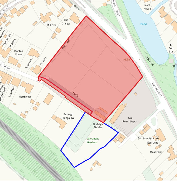
The site (highlighted in red) is used as paddock land for horse grazing, and fronts on to the A20, Ashford Road. The site is made up of two titles, the larger square title fronting the road, with the second smaller title running along the southern boundary.
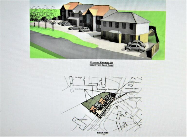
The site forms part of a neighbourhood allocation as part of Charing Parish Neighbourhood Plan. The allocation assumes approximately 48 dwellings and the provision of a 0.3 acres plot reserved for the delivery of a new Community Hall.
The allocation includes an additional parcel of land (shown in blue) that provides 0.4 hectares / 1 acre (Title K534210). This area is also available via separate negation. Historically, this rear parcel contained allotments which are now disused.
The site is bordered by residential to the West and South, with a commercial yard to the East. There is a public footpath that runs from the Ashford Road down to Burleigh Road (which provides easy access to Charing Station). Burleigh Road is a private road and provides the existing vehicular access to the site.
Sorry, no records were found. Please adjust your search criteria and try again.
Sorry, unable to load the Maps API.
Comments are closed.